Live Dallas weather: Flood watch in effect for multiple counties
DALLAS – It was a loud night across North Texas as heavy rain and severe storms moved through early Monday, dropping more than 3 inches in some areas. Conditions have since quieted down across the Metroplex.
LIVE: Dallas-Fort Worth Radar

Monday Forecast
A flood watch is in effect for Anderson, Bosque, Ellis, Freestone, Henderson, Hill, Johnson, Navarro and Red River counties until 7 a.m. tomorrow.
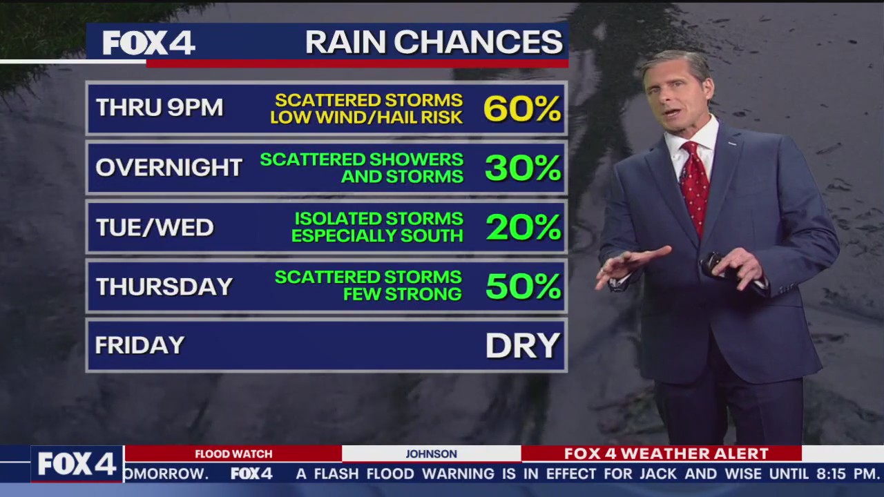
The strongest storms could have marginal hail-wind risks, with the heaviest in DFW south.
Temperatures will remain in the 70s, with the highest rain chances south of I-20.
Collin County storm damage

McKinney’s serious storm damage from overnight storms
The McKinney area spent their Memorial Day holiday cleaning up from last night’s thunderstorms as Collin County saw a lot of down trees, big piles of branches on curbs, and many Oncor crews working to restore power.
7-Day Forecast

Tuesday and Wednesday will be calmer, with only spotty showers possible. Highs will range from the low to mid-80s.
Rain chances increase again on Thursday, with the potential for heavier downpours along with low-end wind and hail risks. The system is expected to clear out by Friday.
A few more showers are possible on Saturday night.
The Source: Information in this article comes from Meteorologist Evan Andrews and the National Weather Service.